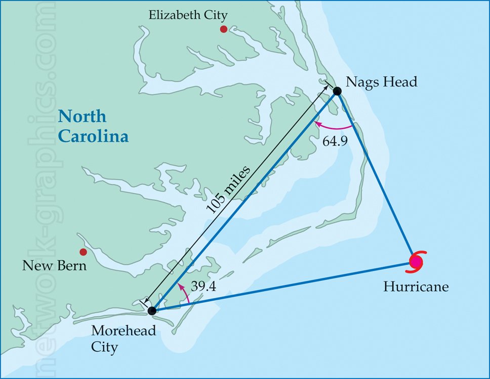
Hurricane Path and Angular Measurement in North Carolina Map.

This detailed map illustrates the trajectory of a hurricane as it approaches the coast of North Carolina, highlighting distances and angles between key locations including Nags Head, Morehead City, and the hurricane’s position. Useful for geography and trigonometry lessons, this map aids in understanding hurricane tracking, angular calculations, and distance measurement in real-world contexts.
We can provide sample images or create custom illustrations tailored to your projects. If you are looking for an illustration of this type, or from another subject area, you can contact us to discuss your needs.
Network Graphics / Division of Abramson & Wickham Graphics Inc.
All rights reserved.

