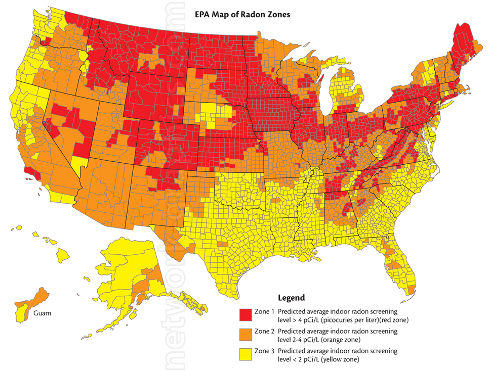
EPA Map of Radon Zones in the United States.

This detailed EPA map provides a visual representation of radon exposure risk across the United States, making it an essential resource for environmental science and health textbooks from elementary to high school levels. The map highlights the predicted average indoor radon screening levels by county, helping students understand geographic variations in radon exposure and the potential health risks in their communities.
We can provide sample images or create custom illustrations tailored to your projects. If you are looking for an illustration of this type, or from another subject area, you can contact us to discuss your needs.
Network Graphics / Division of Abramson & Wickham Graphics Inc.
All rights reserved.

