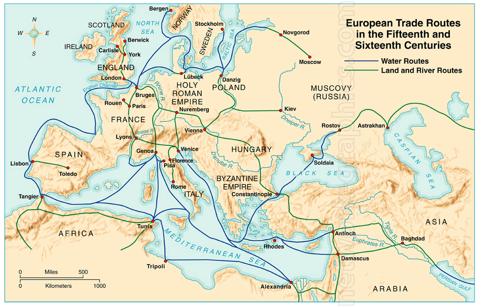
European Trade Routes in the 15th and 16th Centuries.

The map depicts Europe and parts of North Africa and Asia, highlighting the trade routes of the 15th and 16th centuries. Water routes, shown in blue, connect major cities along the Atlantic Ocean, Mediterranean Sea, and Black Sea. Land and river routes, shown in green, traverse key regions such as the Holy Roman Empire, Italy, and the Byzantine Empire, extending towards Russia and the Middle East. Important cities and trade hubs, including Venice, Constantinople, Paris, and Moscow, are marked.
We can provide sample images or create custom illustrations tailored to your projects. If you are looking for an illustration of this type, or from another subject area, you can contact us to discuss your needs.
Network Graphics / Division of Abramson & Wickham Graphics Inc.
All rights reserved.

