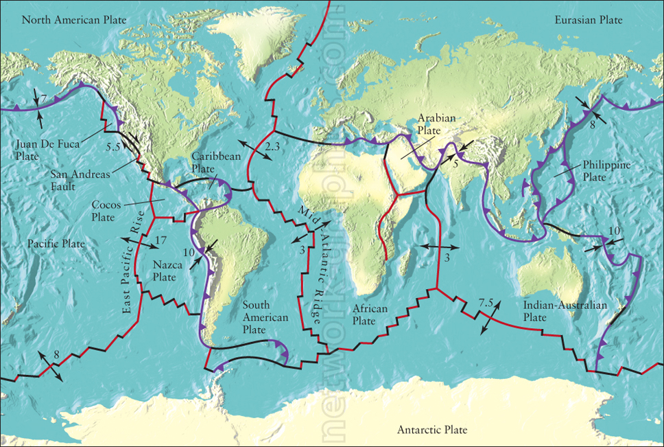
Global Plate Tectonics and Boundary Movements.

This detailed map illustrates the Earth’s tectonic plates and their boundaries, making it a crucial visual aid for earth science and geology textbooks at both elementary and high school levels. The map highlights the major plates, fault lines, and direction of movements, helping students understand the global dynamics that shape earthquakes, volcanic activity, and continental drift.
We can provide sample images or create custom illustrations tailored to your projects. If you are looking for an illustration of this type, or from another subject area, you can contact us to discuss your needs.
Network Graphics / Division of Abramson & Wickham Graphics Inc.
All rights reserved.

